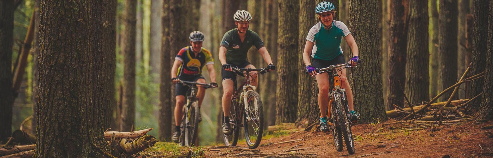
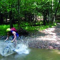
Mountain Bike Capital of the East

Mountain Biking
 Roanoke, Virginia, was the first East Coast community with a Silver-Level Ride Center designation by the International Mountain Bicycling Association (IMBA); come see why we’re the Mountain Bike Capital of the East.
The Blue Ridge Mountains have produced the best mountain biking trails in the East Coast. Whether you are into single speed, downhill, or cross country you will be spent after a day on these trails.
The region is home to multiple trail systems — Mill Mountain Park, Explore Park, Douthat State Park, and Carvins Cove to name a few — that include multiple ride options that can give you a short half-hour ride or occupy you all day long. Add each of these areas to your bucket list, check them off one at a time, and be prepared to come back again and again.
And we’re not ashamed to say the region is home to a few stand-alone epic trails as well. These are classic Roanoke mountain bike rides and not for the faint at heart. Some are one-way rides, so consider a shuttle and plan in advance. These adventures include the Patterson Creek Trail System, Arcadia Up and Over, Dragon’s Back and Dody Ridge.
- Gravity riders check out a list of classic downhill mountain bike routes cultivated by locals
- Looking for some gravel, we’ve got our local favorites gravel rides too
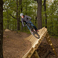
Mountain Biking
- Carvins Cove Natural Reserve


Carvins Cove Natural Reserve is the second largest municipal park in the nation. It holds a major water source within its 12,700 acres and overflowing recreational opportunities including hiking, biking, fishing, and boat rentals. The cove includes 11,363 acres that are protected by the largest conservation easement in Virginia’s history.
With more than 60 miles of trails and an 600-acre reservoir Carvins Cove is a mountain biking, hiking, horseback riding, fishing, and boating paradise.
- There are three entrances to the Cove:
- Explore Park
 Explore Park, located adjacent to the Blue Ridge Parkway, is a 1,100-acre preserve, situated along the Roanoke River Gorge, offering both IMBA-certified mountain bike trails and access to hundreds of miles of the Blue Ridge Parkway. Mountain bike trail options (6+) ranging from 0.5 miles to 10+ miles, and includes a beginner bike skills area. Many of the trails are loop trails, and are easy to moderately difficult.
Explore Park also offers Treetop Quest aerial adventure course, Mayflower Disc Golf Course, river access, camping, cabins/yurts/RVs, and the historic Twin Creeks Brewpub.
- Mill Mountain Park
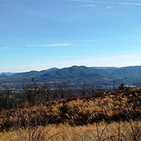
Less than 5 minutes from downtown Roanoke, Mill Mountain Park offers incredible mountain biking (9 miles) within 5 minutes of downtown Roanoke. The trails encompass Roanoke’s highest point – the summit of Mill Mountain (1,703 feet) and the Roanoke Star. This area offers 900 acres of parkland atop Mill Mountain, picnic areas, two overlooks that provide 20-60 mile vistas, access to additional hiking trails, the Mill Mountain Zoo, and Mill Mountain Discovery Center.
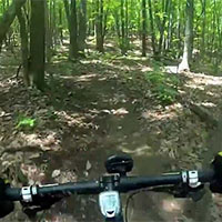
- Watch a video of mountain biking on Mill Mountain
- See live video from the StarCam
- Download a Mill Mountain Park Trail Map
- Douthat State Park
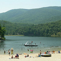 Douthat State Park was named one of the nation’s 10 best by Outside Family Vacation Guide. It is one of the original six Virginia State Parks. Nestled in Virginia’s Western Highlands, Douthat features some of Virginia’s most outstanding scenery.
- Swimming beach
- Boat, kayak, and canoe rentals
- Cabin rentals
- Campsite rentals
Some people refer to it as the Disneyland of mountain biking. There are more than 43 miles of wooded hiking trails and mountain biking trails to choose from, ranging from easy to difficult. Many park trails climb up the side of the surrounding mountains for several miles and reward mountain bikers with grand views and long flowing descents.
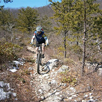
- North Mountain Trail: Dragon’s Back
Dragon’s Back is the sister trail to Dragon’s Tooth. This spiny ridge trail is very technical and often requires some hiking with your bike, but the rewards are well worth the effort. It is an 11-mile single-track loop with technical climbs and descents. The rocky trail starts and finished off FS road 224.
- Fort Lewis Mountain (Havens WMA)
 Havens Wildlife Management Area occupies a 7,190 acres of Fort Lewis Mountain, about 5 miles west of Roanoke area. This is steep and generally inaccessible terrain except to the hardiest of hardcores. Elevations range from 1,500 to 3,200 feet. There is very little water present, occurring only in small intermittent streams that flow through the area during wet periods and several water holes constructed for wildlife. The biking is incredible … but you’d better plan on being out there for a full day.
Havens has two primary public access points, the Carroll’s Access Road from Route 619 (Wildwood Road) on the south side and Route 622 (Bradshaw Road) where it joins the area’s northwest boundary. Access from Interstate 81 at Salem is via Route 619 or 311 North toward Catawba.
- Dody Ridge
 Dody Ridge cooks up a killer 2.8 mile 1,500-foot climb to warm up, a mellow Blue Ridge Parkway portage, a fun, pedal-assist downhill, and finishes with some mean rock stew that just keeps getting rougher and tougher.
The loop path is 12 miles total and is located in Montvale.
- Pandapas Pond & Poverty Creek Trails
 The Poverty Creek Trail system (also known as Pandapas Pond) is a network of multi-use trails perfect for hiking, running, horseback riding, and mountain biking. There are more than 20 miles of trails of varying degrees of difficulty.
Poverty Creek Trail is the easiest of the trails in this system. It is a series of small ups and downs and is ideal for mountain bikers of all skill levels but especially great for those just getting into the sport. Think of Poverty Creek Trail as the “spine;” many trails branch off of Poverty Creek that are more challenging.
-
Fairy Stone State Park
Fairy Stone State Park, the largest of Virginia’s six original state parks (4,741 acres), is home to its namesake “fairy stones.” These rare mineral crosses and the park’s scenic beauty, rich history, and ample recreational opportunities make it a local and regional favorite.
More than 9 miles of multi-use trails and a 168-acre lake will keep you busy. The park is also just minutes from the Blue Ridge Parkway.
-
Falling Creek Park
 The trail network in Falling Creek park is designed for hiking, mountain biking, and trail running and includes 8.5 miles of trails of varying difficulty. In addition to trails, there is an 18-hole disc golf course at the park.
Falling Creek Park is also home to the Fat Tire Frenzy & Bike Festival.
-
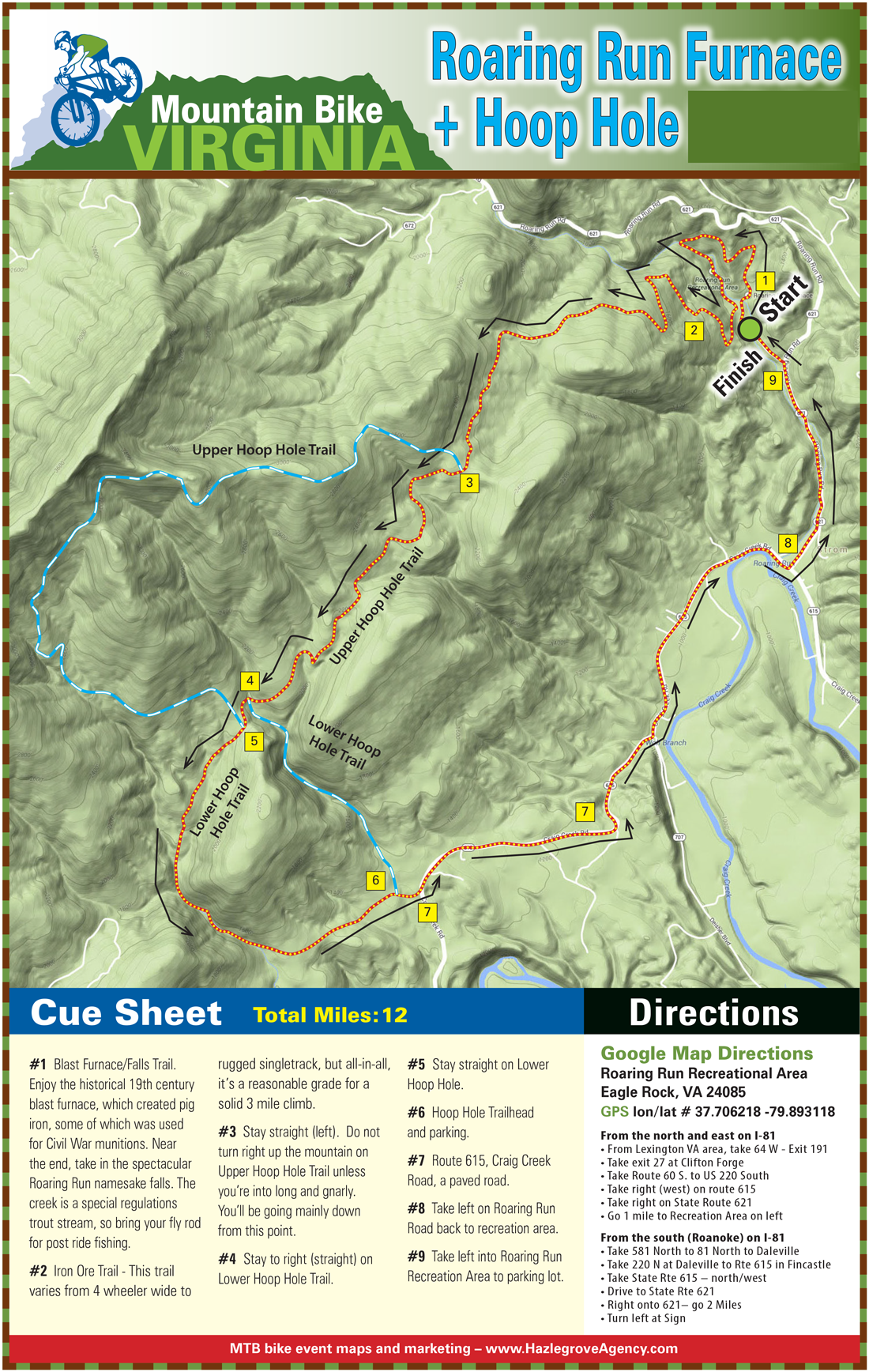
Hoop Hole
 Hoop Hole Loop has two loops. The lower loop is 4 miles and skips the views from the ridge top and the extended loop is 9 miles. Both loops offer beautiful views of the streams cascading over rocks and swimming holes.
The longer loop climbs to the top of the ridge for scenic views of the surrounding mountains. One could try to reach certain cliffs from the ridgetop for more expanded views. The trail is very rugged and good footwear is necessary. Also, the trail makers are sometimes difficult to see with yellow blazes.
-
Liberty Mountain Trail System
 The Liberty Mountain Trail System includes more than 50 miles of single- and doubletrack trails and logging roads spanning approximately 5,000 acres. The mountain rises to over 1,360 feet offering cross country and gravity-fed trails for both hiking and mountain biking. The trail system is located in close proximity to the Liberty Mountain Snowflex Centre, about 1 hour from Roanoke.
 -
Montvale Park
 Montvale Park includes 6.5 miles of entirely wooded single-track trails. Most stream crossings have foot bridges or easily forded.
Wildlife in this area include deer, turkey, squirrels and the occasional coyote. While the rest of the park is still in development, the trail system is complete and ideal for mountain biking, trail running, and hiking.
-
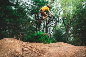
Morningside Bike Park
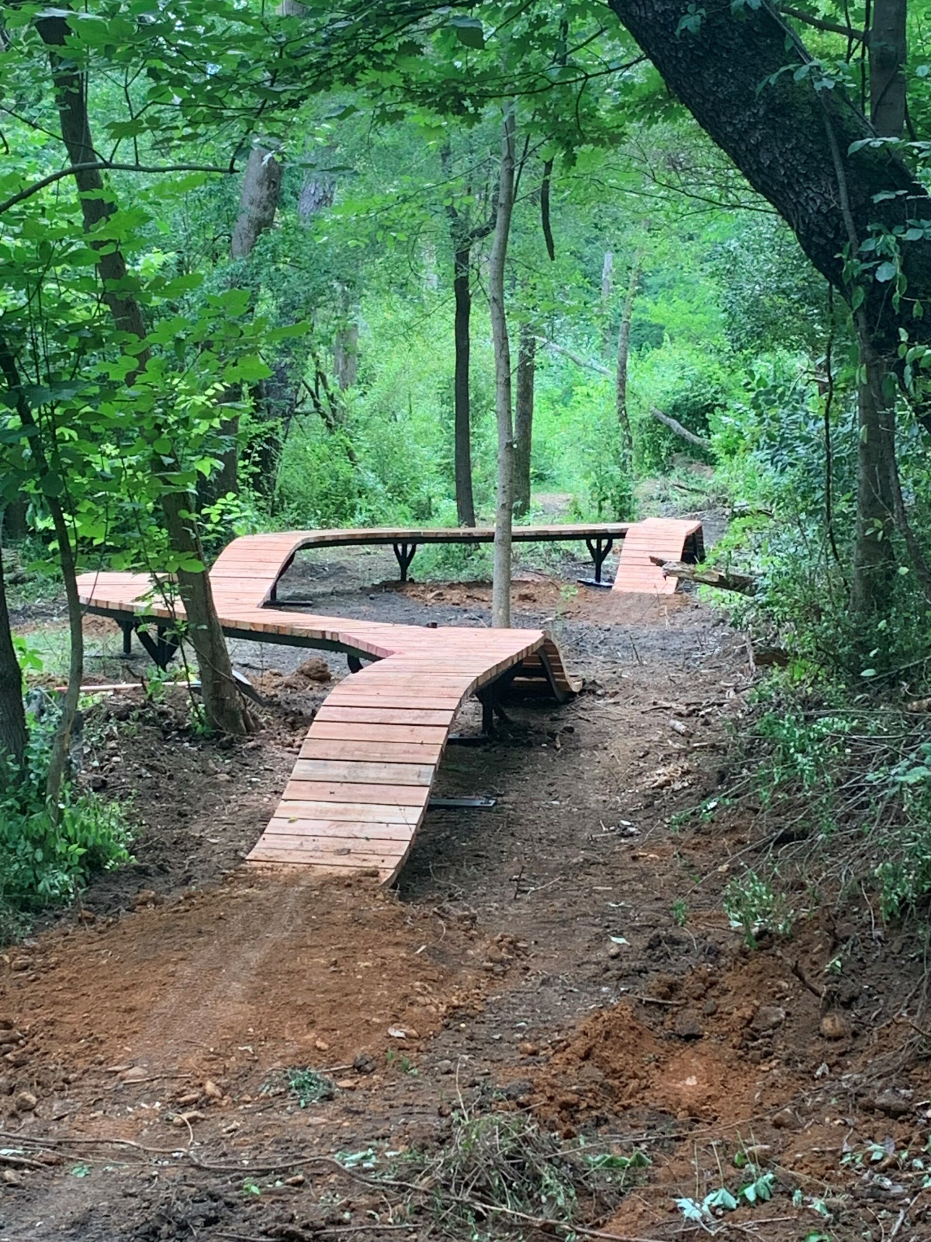 Morningside Bike Park is a work-in-progress.
The park is being transformed into a bike park by volunteers, led by local mountain bike club Blue Ridge Off-Road Cyclists.
As of summer 2023, there is a 1.25 mile loop “flow trail” designed for beginners that is located in the forested portion of the park and then several jump and flow lines located in the open field area of the park.
-
MTB at Waid Park
 Experience the Old Buzzard at Waid Park in Franklin County. The trail incorporates elements of flow and freeride features into a one-of-a-kind progressive experience unique to our region.
 -
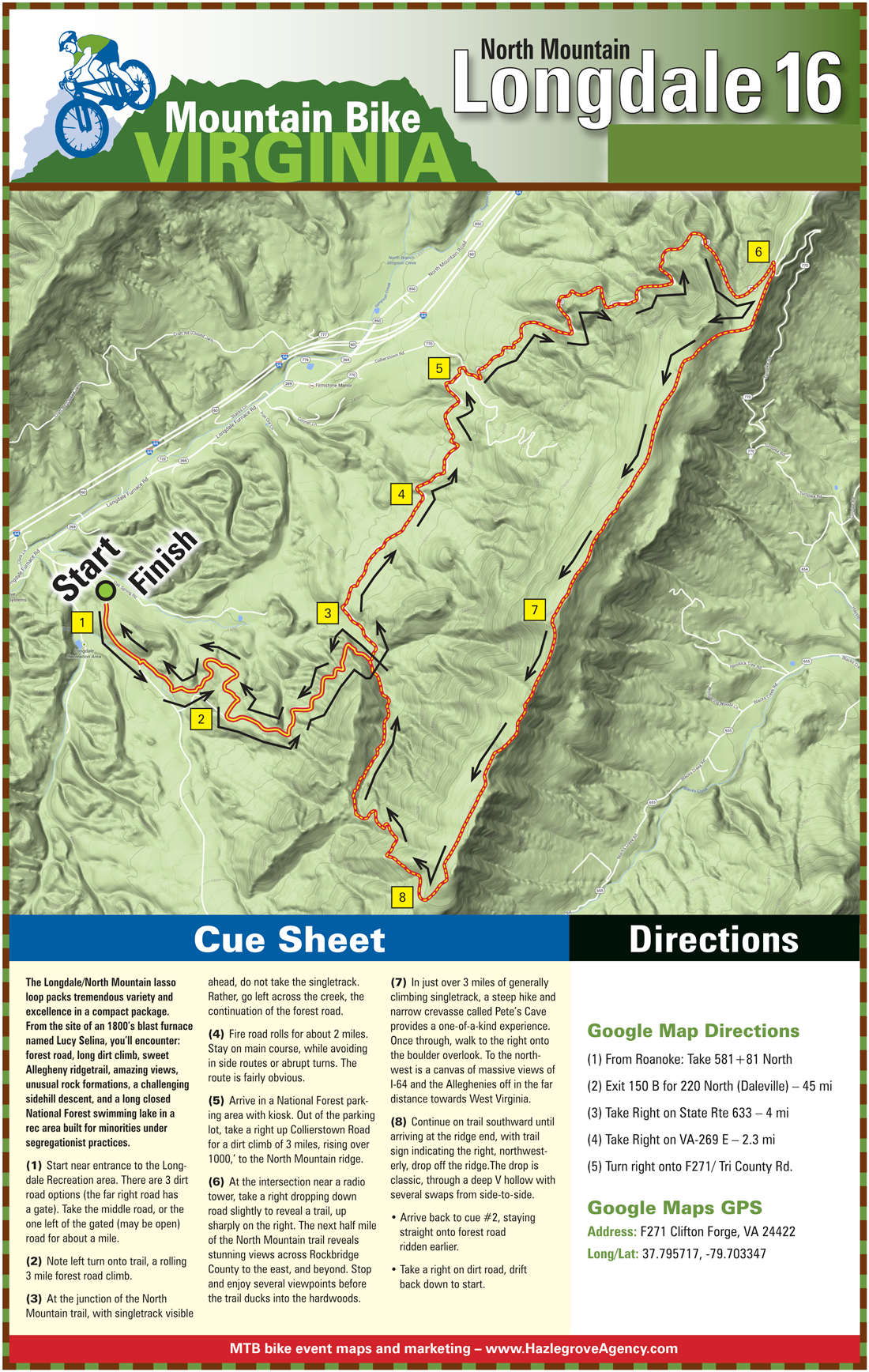
North Mountain Trail at Longdale Furnace
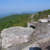
 It’s a long climb to the top of North Mountain, but the ridge top single-track trail that awaits is well worth it. Get ready for awesome cliff-top views and a sometimes technical but mostly smooth trail. At the high point you’ll ascend a stone staircase between house-sized boulders to a craggy pinnacle. The ride back down is fast and furious for a total ride of 16.5 miles.
This trail is not the North Mountain Trail near Dragon’s Tooth. Combine this ride with the Whiterock Tower ride.
Distance
- There are 8.42 miles of the main trail system, but shorter routes are available, and the trail can be lengthened to 13.2 miles.
Hike it
- The trail heads southwest along North Mountain, and at Mile 3, narrow rock stairs ascend between huge boulders. There is a wide view of the surrounding landscape from atop the boulders.
- The trail takes a sharp right turn as you move off the mountain and into Longdale Recreation Area.
- It drops down off the ridge and follows a drain for a short distance until it intersects with the FT 467B – North Mountain Trail Connector.
- It then turns south around the nose of a ridge and drops down into Bob Downy Branch.
- Soon after reaching Bob Downy Branch the trail crosses Fire Road 271 (Tri County Road). The trail follows Bob Downy Branch to the intersection with FT 658 (Yaccr’s Run Trail). The trailhead at FR 447 and SR 770 is difficult to access in the winter months because of snow and ice accumulations on road surfaces.
Directions/Parking
- From Roanoke, Take I-81 N to US Hwy 220 N off exit 150B in Cloverdale. Stay on US Hwy 220 for 30 miles to Iron Gate where you will turn onto Longdale Furnace Rd/ US Hwy 269. Turn right onto Tri County Road, and you will have arrived at the destination in just under a mile.
- Parking is available at the trailhead.
-
Patterson Creek Trail System
 Located on the border of Craig and Botetourt counties is the Patterson Creek Trail System. This forgotten hiking trail system that is being revived by the Roanoke IMBA chapter and includes multiple loop options and fairly difficult terrain.
 -
Potts Mountain Jeep Road
 Potts Mountain Jeep Road is a great spot to combine mountain biking with camping, trout fishing, and hiking near the Pines Campground, Barbours Creek, and Lipes Branch Trail. Consider having someone drop you off at the top of FS 176 to avoid a long and arduous forest service road climb.
The loop uses paved road, gravel forest service roads, and a rough jeep road that takes you along a gorgeous ridge line. The 17-mile loop is well worth the journey.
-
Poverty Creek
Poverty Creek (also known as Pandapas Pond) is one of the area’s premier destinations for single-track mountain biking. More than 20 miles of trail options, with steep climbs and fast down hills will keep your heart pounding.
-
South Pedlar ATV Trail System
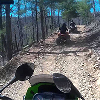 The South Pedlar ATV Trail System (Terrapin and Rattlesnake Trails) is a looping network of approximately 19 miles of trails in the Bedford area. Riders will find challenges in the narrow and twisting trails, while others will find trails that are wide and inviting to riders of most all levels.
This area is open to ATVs and motorbikes, as well as mountain bikes. Visitors enjoy panoramic vistas, groves of large trees, spectacular mountain laurel blooms in season, and shady forest canopy.
-
Waid Recreation Park
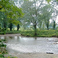
 Waid Recreation Area is a 220-acre facility located near Rocky Mount, along the site of the Old Carolina Wagon Trail. The park is nestled near the Pigg River, which is home of the “Pigg River Ramble.”
More than 400 acres of rolling terrain and creek crossings make this area great for beginners and more experienced hikers and bikers. The location also hosts various special events and athletic leagues.
Amenities include:
- Brand new flow and jump like mountain bike trails
- 7 miles of walking and hiking trails
- Disc golf course
- 2 walking tracks
- Equestrian trails
- Covered picnic shelters, pavilions, and grills
- 2 playgrounds
- Fishing, canoeing, and kayaking
- Soccer, baseball & softball fields
-
Whiterock Tower Trail
Whiterock Tower is a 12-mile loop series of switchbacks on an old forest service road bordering the Rich Hole Wilderness. It takes you up to the remains of Whiterock Tower. On this knife-like spine of a ridge you’ll enjoy good views as you ride past house-sized boulders. Combine this ride with the North Mountain Trail at Longdale Furnace.


Create Your Own Land Adventure
Get Started Powered by Roanoke Outside